Tuesday, March 31, 2009

The Red is still on the rise.

The Red River has passed the Flood level of 1979 (48.81 ft) and is now at 49.07 ft. It is now the third highest flood on record and still on the rise. The dike system is built to protect to 60 feet. The crest is now predicted to reach 51 ft.

When I was a kid everyone compared the river level to the 1950 or 1966 flood. In high school the 1979 flood became the new benchmark to compare the river level with. Now its the 1997 flood that is the benchmark. Let us hope that the 2009 flood does not become a new benchmark.


USGS Image


USGS Chart 3/31/09

Saturday, March 28, 2009

Flood update

Made another trip to the County Office Building Parking Ramp on Friday (March 27th) to check out the flood waters. The river level is currently a bit over 48ft and is now expected to hit 51ft. It has been cold out and that is helping out with the melt.


This is a popular spot for viewing the river.


Here is a GFPD Officer. The Police were busy trying to keep people from walking on the dike. I'm not sure if there is a fine, but in Fargo they will through you in jail for setting foot on a dike.


The Sorlie Bridge.


Cabela's across the river in East Grand Forks.


Looking towards the Forks.

Friday, March 27, 2009

More Flood of 2009

March 26 Flood Pictures

After our visit to East Grand Forks we headed to Downtown Grand Forks and drove up the County Office Building parking ramp to catch the view. Lot's of people had the same idea.


This is the Sorlie Bridge. The flood wall pictured is the closure gate for the BNSF rail bridge that is currently closed.


A wider view.


If you looked in the above photos you can see this Flood Obelisk which marks the 5 major flood levels of the Red River.


If you click on this photo you can see the obelisk with the record 1997 flood level marked.


This is a view of the BNSF rail bridge looking into East Grand Forks.

This is the Point Bridge near the forks of the Red Lake River and the Red River of the North. It is also closed.


You can see the Louis Murray bridge on the Red Lake River in this view. It is now closed.


You can see both bridges in this view. The Crystal Sugar factory is in the background. The buildings in the foreground are two of the oldest Downtown buildings left. They were moved after the 1997 flood.


Flood of 2009

March 25 Flood Photos.

We made the drive over to East Grand Forks after work to check out the river. The University classes are canceled until Tuesday, but we are still open for business. We are in a lot better shape for this flood than we were in 1997. We may get a record flood, but the levee system is built up to 60 feet. The Red is forecasted to reach about 53 feet here. Of course Fargo was told it was going to get 39 feet and now they are looking at 42 feet.

St. Anne's Guest Home in Grand Forks. The Stairs in front are part of the flood wall.
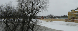

This is now part of the Red River State Recreation Area in East Grand Forks. There used to be homes here. They were torn down after the flood of 97 to make way for the flood control project.


This is the flood wall on Demers Avenue in EGF in the Cabela's parking lot looking north at Whiteys.


Here are some fools walking on the earthen levee next to the Blue Moose. Not a nice day for a swim. I stayed off the levee. In Fargo they would be tossed in jail.


The flood wall in front of the Blue Moose.


The flood wall in front of Whiteys and Applebees.


The Sorlie Bridge.


The Sorlie Bridge was just about ready to have water overtake the road. I'm sure is is flowing over it today.


A close up of the Sorlie Bridge looking at the flood wall in Downtown Grand Forks


The first bridge is the railroad and the second one with the Point Bridge. Both are closed.


You can see the Grand Forks Herald Building. The turnstile trestle in the middle of the river is all that is left of the old Pillsbury Railroad Bridge. It was torn down after the 97 flood. It used to turn to allow the passage of steamboats.


Heading back into Grand Forks on the Kennedy Bridge. The Kennedy Bridge may be closed this weekend.

Wednesday, March 25, 2009

Winter is Back.

The river is on the rise and winter is back. We had 6-8 inches of snow last night and today. UND was closed so we had the day off. The current water level is 44 feet. The dikes are built for a 60 foot flood and the crest is predicted to reach 52 feet. It is still making me a bit nervous.

I have some before and after photos.


The Riverside Dam North End Bike Bridge on Sunday.


The same view today (Wednesday).


Riverside Dam parking lot on Sunday.


Check out the Kiosk that is almost under water today (Wednesday).


A close up of the Kiosk.


The ice was jamming up behind the Bike Bridge at Riverside Dam.


The following were taken on Kennedy Bridge driving East (looking south).


In front of St. Anne's.


Heading back west over the bridge. This is River Road in EGF.


Tuesday, March 24, 2009

Roy Lake View

A view of Roy Lake from the air. You can see Twin Lakes in the west.

Flood Wall

I thought that I would post some floodwall pictures. They were taken Friday and Sunday Evening. The Red River level is raising 3-4 feet per day now.

This is the invisible floodwall that has been installed in EGF. You can see Whiteys and the Blue Moose.
The Sorlie Bridge.

This is the area when as the city of EGF was installing the aluminum stop logs in the wall.

The Blue Moose Behind the wall.


This is the floodwall on the Grand Forks side of the river. The county office building is in the background. For you fellow old timers this was the location of Sweet Clover Dairy and the big silver water tank.


This is the dry side of the wall in GF.